Reference Plan (R-Plan)
Reference Plan
Are you looking to divide a piece of property to sell additional lots? Or splitting a beloved cottage property to family members? Or have an agreement with a neighbor to purchase some of their land? Any time there is a need to divide a lot to create new ones (called land severance), or to prepare a portion of a property for a widening or transfer, or to describe utility easements and private and public rights-of-way, a Reference Plan (R-Plan) would most likely be necessary.
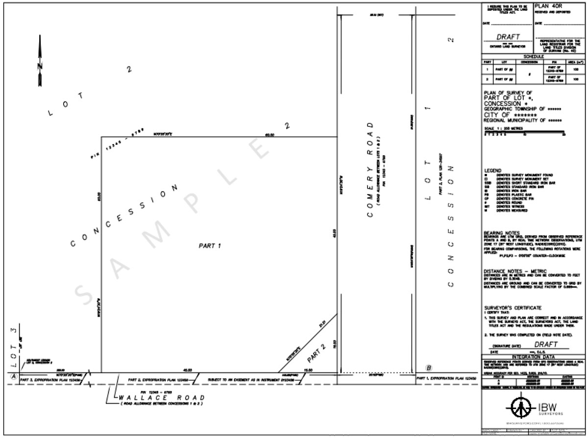
A Reference Plan (R-Plan) is a Plan of Survey deposited in the local Land Registry Office and recorded on title to describe parcels of land and their boundaries. Land severance is a highly regulated process and a challenging one due to differing requirements amongst local municipalities. A general guideline is difficult to establish, but I.S Surveying & Geoinformatics LTD can help steer through the entire process to save you time, money and frustration.
Land Severance Process
I.S Surveying & Geoinformatics LTD have experience preparing Reference Plans and fulfilling consent conditions in municipalities and townships right across Nigeria and can help you:
- Navigate through complexities. I.S Surveying & Geoinformatics LTD has experience working with townships and municipalities directly and knows their requirements to ensure a smooth process.
- Save time and money. I.S Surveying & Geoinformatics LTD has deep knowledge of municipal requirements to provide what municipalities want, and help minimize risk of delays or rejections.
- Find peace of mind. We will assign dedicated project managers to take care of your project from start to finish.
Depending on the municipality you may need to have a “Severance Sketch”, also called a “Draft Reference Plan”, to submit to the local authorities for approval before a Reference Plan is deposited. In this case the property would be surveyed, the proposed parts would be illustrated in “draft” form for submission. Once the draft plan receives all required approvals the plan can be finalized and submitted to be deposited at the Land Registry Office. This process typically takes from 10 to 15 business days with the Registry Office. Once deposited, a Lawyer can then use the Part(s) on the new Reference Plan for the description of the portions of land to be conveyed or have interests registered.
A Reference Plan, although deposited, does not have any effect until Part(s) on the plan are referenced by a Lawyer in a transfer document or an application to amend a parcels description is submitted. Once deposited, these plans are now public record and can be found at the local Land Registry Office.
Contact I.S Surveying & Geoinformatics LTD
Reference Plan Question?
We're here to help.
Reference Plan Project Flow
Step 1
Request a Quote
Call us at: +2348036493006 or Request a Quote Online
Step 2
A dedicated Project Manager will take care of your file:
- File proceeds to Research
- PM reaches out to you for any special requests
- Field Work
- Calculations and drafting of the survey plan
- We reviews field work and draft plan
Step 3
Draft plan issued for review (by municipalities or yourself).
Step 4
Revisions and Final Field Work.
Step 5
Plan deposited in Land Registry Office.
Step 6
Your Lawyer completes transfer of land.
Talk to a Surveying Expert
Have a Question on Reference Plans?
If you have a Vision, we will help you to turn it into reality

