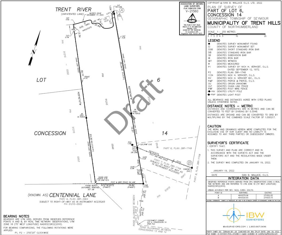
Plan of Survey
Plan of Survey
Any survey plan that illustrates a boundary is called a Plan of Survey. There are some specific kinds of survey plans, such as Reference Plans (Plans that are filed as public documents at the Land Registry Office) and Surveyor’s Real Property Reports, but these are just specific categories of a Plan of Survey. Basically every plan that shows a legal boundary is a Plan of Survey.
Often a Plan of Survey is prepared to meet the specific needs of our clients. Some homeowners may require a plan to show the relationship of a fence line to a property boundary, or to illustrate the dimensions and area of their property, or to show that a new garage was built in compliance with zoning setbacks. A Plan of Survey can take on many forms and can be used for many purposes, but they will all show one or more boundary lines, and usually the relationship of physical features (ditches, buildings, fences, trees, retaining walls) to the surveyed boundary lines.
Contact I.S Surveying & Geoinformatics LTD
Plan of Survey Question?
We're here to help.
Plan of Survey Process
Step 1
Request a Quote
Call us at: +2348036493006 or Request a Quote Online
Step 2
We will help determine the product that best meets your needs.
Step 3
A dedicated Project Manager will take your project from start to finish:
- A dedicated Project Manager (PM) is assigned
- File proceeds to Research
- PM reaches out to you for any special requests
- Field Work
- Calculations and drafting of the survey plan
- Nigeria Land Survey reviews field work and draft plan
- Nigeria Land Surveyor signs the final Plan
Step 4
An Nigeria Land Surveyor reviews and signs the plan, Project Manager arranges delivery.
Talk to a Surveying Expert
Have a Question on a Plan of Survey?
If you have a Vision, we will help you to turn it into reality

